The Norway mirror: projecting Scandinavian lessons onto Bruny Island and Southern Tasmanian waters
Two recent investigations—one an exclusive Guardian report published 4 May, the other a major Sunstone Institute multimedia feature—have laid bare the cumulative ecological cost of Norway’s salmon farming industry. Their findings are not merely of academic interest to Tasmania. The parallels in production methods, regulatory architecture, and receiving environments are so close that the Norwegian data functions as a predictive mirror, offering a glimpse of what may already be unfolding beneath the surface of the D’Entrecasteaux Channel, Storm Bay, and Macquarie Harbour.
The Norwegian baseline
The Sunstone Institute’s analysis of 2025 data reveals that Norwegian aquaculture—the world’s largest farmed salmon producer—released 75,000 tonnes of nitrogen, 13,000 tonnes of phosphorus, and 360,000 tonnes of organic carbon into coastal waters in a single year. These quantities are equivalent to the untreated sewage of 17.2 million people for nitrogen, 20 million people for phosphorus, and 30 million people for organic carbon—the latter roughly matching the entire population of Australia. For a country of just 5.5 million, the nutrient output of fish farms exceeds the human population’s contribution by a factor of three to five.
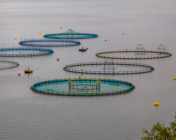
The mechanism is straightforward. Less than half the nutrients fed to farmed salmon are absorbed for growth; the remainder is excreted as faeces and urine, or settles as uneaten feed. Across Norway’s 995 open-pen sea farms and 180 hatcheries, this amounts to an estimated 63,871 tonnes of uneaten feed entering the marine environment annually—the equivalent of 4,500 dump trucks backing up to the water’s edge. All of this occurs with “little or no waste management”.
The ecological consequences documented by the Sunstone investigation are stark: kelp forests smothered by thick blankets of nuisance algae (“lurv”) along a thousand-mile stretch of coastline; explosions of sea urchin populations feeding on waste and denuding rocky reefs; a one-third decline in deep-water oxygen in the Hardangerfjord between 1955 and 2024; and the recent emergency rejection of nine new fish farm applications in Vestland county to protect the collapsing fjord ecosystem.
Projecting the data: Tasmania’s nutrient footprint
To project Norway’s findings onto Tasmania, the most robust methodology uses population equivalents—the standard comparative tool employed by both the Sunstone Institute and the Australia Institute.
The Australia Institute has calculated that Tasmanian salmon farming produces approximately 4,193 tonnes of dissolved inorganic nitrogen (DIN) per year. This is derived from the industry’s own data: a feed conversion ratio of 1.35 (1.35 kg of feed to produce 1 kg of salmon), with approximately 5% of feed mass released as nitrogen, of which 85% is dissolved. Macquarie Harbour alone—representing 13% of Tasmanian production—contributes 545 tonnes of DIN annually, equivalent to 1.6 times the treated sewage output of the city of Hobart.
Scaling this to the Norway comparison and adjusting for treated versus untreated sewage equivalence yields the following projections for Tasmania’s salmon farming nutrient releases:
Nitrogen (total) ~4,900–5,500 tonnes/year (t/a)
Raw Sewage Equivalent (people): ~1.1–1.3 million
Equals ~2× Tasmania’s population
Phosphorus (total) ~850–950 t/a
Raw Sewage Equivalent (people): ~1.3–1.5 million
Equals ~2.4× Tasmania’s population
Organic carbon ~23,000–26,000 t/a
Raw Sewage Equivalent (people): ~1.9–2.2 million
Equals ~3.5× Tasmania’s population
Dissolved Inorganic Nitrogen (DIN) ~4,200 t/a
Raw Sewage Equivalent (people): ~3.0 million (treated sewage equivalent)
Equals 6× Tasmania’s entire sewage output; 12× Hobart’s sewage
The headline figure is stark: Tasmanian salmon farms release DIN pollution equivalent to the treated sewage of approximately 3 million people—roughly six times the nutrient load of every sewage treatment plant in Tasmania combined, or twelve times Hobart’s sewage.
Expressed in Norway’s “raw sewage” framework, the nitrogen alone equates to the untreated waste of a population larger than greater Adelaide.
Production scaling: how Tasmania compares to Norway
Norway produces approximately 1.5–1.6 million tonnes of salmon annually. Tasmania’s 2024–25 harvest was approximately 68,000 tonnes (gutted weight). This means Tasmania produces roughly 4.3% of Norway’s tonnage. However, Tasmania’s nitrogen output per tonne of production appears to be higher than Norway’s—a discrepancy that may reflect warmer water temperatures driving higher metabolic rates, elevated feed conversion ratios during disease events, or the extraordinarily high mortality rates documented in 2025–26.
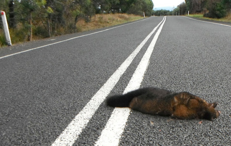
In 2025 alone, 20,133 tonnes of salmon—approximately four million fish—died prematurely in Tasmanian pens before reaching harvest, representing a mortality rate of 20–25% of all fish produced. In the first quarter of 2026, a further 9,000 tonnes of mortalities were recorded. These fish were fed, medicated, and their decomposing biomass contributed nutrients to the water column. Norway has not publicly reported mortality rates approaching this scale.
From Fjords to Channels: the receiving environment
The Norwegian experience offers particularly troubling lessons for three Tasmanian water bodies.
Macquarie Harbour is Tasmania’s closest analogue to a Norwegian fjord: a semi-enclosed, stratified, poorly flushed system. The Australia Institute has already calculated that salmon farming in the harbour generates nitrogen pollution equivalent to the sewage of a city of half a million people—more than double Hobart’s population. This nutrient load drives the oxygen depletion that threatens the critically endangered Maugean skate, whose population halved between 2014 and 2021. The Hardangerfjord’s one-third oxygen decline since 1955—driven by nutrient inflows and climate change in roughly equal measure—is a preview of Macquarie Harbour’s trajectory if loading continues.
The D’Entrecasteaux Channel is a complex, island-studded waterway with limited flushing in many bays. Bruny Island sits at its heart. The Norway data on waste plume dispersal from net cleaning—up to 5 kilometres from source pens—is directly relevant here. Beaches such as Coningham and Roaring Beach lie approximately 2.5 kilometres from active salmon leases, well within the documented dispersal radius for biofouling debris containing stinging hydroid cells. In January 2026, pink algal sludge was documented at Randalls Bay, Little Roaring Beach, and Little Taylors Bay on Bruny Island, accompanied by reports of dead sea cucumbers, octopuses, and crabs washing ashore. Norwegian scientists have documented that seasonal nutrient surges peak in summer—precisely when warming waters make ecosystems least resilient to additional loading.
Long Bay, near Port Arthur on the Tasman Peninsula, represents the most concentrated example. The Tasmanian Independent Science Council found that a single salmon lease accounted for 95% of human-derived nitrogen inputs to the bay—equivalent to the sewage of more than 25,000 people discharged into a small, shallow, poorly flushed water body. The documented consequences include a 75–100% decline in seagrass cover, chronic nuisance algal blooms, and extensive reef damage. This is a microcosm of the Norwegian pattern: nutrient overload → algal proliferation → oxygen depletion → ecosystem simplification.
Kelp forests, urchin barrens, and the feed station effect
The Sunstone investigation devotes extensive attention to the fate of Norway’s kelp forests—the marine equivalent of terrestrial old-growth forests, providing habitat, carbon sequestration, and coastal protection. The investigation documents kelp smothered by lurv, sea urchin populations supercharged by fish farm waste, and even a celebrated “reference site” (Purkeskjæret)—long thought too wild and tide-swept to be affected—now showing signs of decline.
Tasmania’s giant kelp forests (Macrocystis pyrifera) have already suffered catastrophic declines due to warming waters and the expansion of the long-spined sea urchin (Centrostephanus rodgersii) down the east coast. The Norway data raises the question of whether nutrient plumes from salmon farms in the Channel and Storm Bay are compounding this stress by fertilising nuisance algae that compete with kelp for light and space, or by providing a supplemental food source for urchin populations.
The “feed station effect” documented in Norway—where wild fish congregate at waste discharge pipes, their stomachs distended with half-digested salmon pellets—has direct Tasmanian parallels. The Norwegian finding that waste from a single hatchery can attract hordes of sea urchins from deeper water, which then denude surrounding rocks of life, is a process that could operate identically around Tasmanian lease sites.
The regulatory parallel
Perhaps the most uncomfortable parallel is regulatory. The Sunstone investigation describes a Norwegian governance system split between two ministries with “opposing goals”—the Ministry of Trade and Industry (which prioritises growth and controls licensing via a sea-lice traffic light system) and the Ministry of Climate and Environment (which regulates pollution). The result, as one senior Norwegian official describes it, is a “boiling frog syndrome” where licensing proceeds based on narrow metrics while the wider ecological context is overlooked.
A 2025 audit by the Norwegian Environment Agency found that nine out of ten land-based aquaculture facilities violated pollution regulations. Weeks later, the government proposed a complete regulatory overhaul, acknowledging that the existing framework was inadequate.
Tasmania’s regulatory architecture mirrors this fragmentation. The EPA’s benthic monitoring requirement—that there must be “no significant visual impacts at, or past, 35 metres from the lease area”—is a narrow, localised metric. It does not capture water-column nutrient dispersal, far-field oxygen depletion, or cumulative effects across multiple leases. The total quantity of florfenicol used across eight of nine treated leases remains undisclosed months after the permit was revoked, with the EPA unable to locate the information under Right to Information laws. As the Sunstone report notes of Norway, “what happens elsewhere in the fjord has in general not been measured”.
What this means for Bruny Island
The Norway projection is not a theoretical exercise. Bruny Island’s marine environment—the interface of the D’Entrecasteaux Channel and Storm Bay—is simultaneously one of Australia’s most biodiverse and one of its most industrially pressured. The island is a Key Biodiversity Area supporting the endangered Forty-spotted Pardalote and migratory Swift Parrots. Its waters host handfish, weedy seadragons, abalone, and rock lobster. Its beaches, from Adventure Bay to Cloudy Bay, are central to Tasmania’s identity and tourism economy.
The combined Norwegian and Tasmanian data suggest the following are likely occurring or at high risk:
1. Nutrient accumulation in poorly flushed bays and sections of the Channel, fertilising nuisance algal blooms of the kind already documented at Randalls Bay and Little Taylors Bay.
2. Oxygen stress in deeper waters, particularly during summer when feed rates peak and water temperatures rise.
3. Kelp forest decline exacerbated by the interaction of warming, urchin grazing, and nutrient-driven algal overgrowth.
4. Wild fisheries contamination, as demonstrated by the detection of florfenicol residues in abalone and rock lobster more than 10 kilometres from treated pens.
5. Beach pollution from net-cleaning debris plumes that Norwegian modelling shows can travel five kilometres—placing popular Bruny swimming and surfing beaches within range.
A note of possibility
The Sunstone investigation concludes with a finding of potential relevance to Bruny Island. A study of kelp forests along an urbanised stretch of Australia’s south coast found that “by reducing nutrient runoff and improving wastewater treatment, kelp recovery was possible.” While this required “considerable initial investments and political will, on a small scale the outcome was highly effective. By cleaning up the water, the lurv (Norwegian word for smothering algae cover) receded and the kelp came back”.
Norway’s Vestland county has taken the step of rejecting all pending applications for increased production or new aquaculture sites, with the county governor’s senior advisor stating plainly: “In order to save the fjord all pending applications for increased production or new aquaculture sites will be rejected”.
The question for Bruny Island, for the Channel, and for southern Tasmania is whether the lesson will be absorbed before the mirror becomes all too real.
What you can do:
- Demand transparency: Contact your state MP and request full public release of florfenicol tonnage across all nine treated leases, and nutrient loading data for all Tasmanian salmon farming zones.
- Support independent monitoring: Citizen science observations—algal blooms, unusual beach debris, wildlife changes—are essential given the gaps in official monitoring beyond the 35-metre compliance zone.
- Engage with the EPA’s Environmental Standards review: The current standards are under development; public submissions are a critical lever.
- Support wild fisheries: Purchasing locally caught abalone and rock lobster (when fisheries are open) sustains the sector most directly affected by antibiotic contamination.
Content in this Marine Brief Special Report was machine compiled from: the Sunstone Institute’s “The Waste Beneath the Waves” investigation and nutrient analysis; Guardian Australia reporting (4 May 2026); Australia Institute nutrient loading calculations; Tasmanian Independent Science Council Long Bay assessment; Tasmanian EPA mortality and waste management data; and Norwegian Institute for Water Research (NIVA) fjord oxygen studies. The content is without referreeing or warranty